-
 ×
- ホーム
- アート プリント ▸
- 芸術家 ▸
- カテゴリー ▸
- アート スタイル ▸
- 額縁 ▸
- 印刷媒体 ▸
- すべての印刷メディア
- レオナルド・キャンバス(サテン)
- サルバドール・キャンバス(マット)
- ラファエル・キャンバス(マット)
- ファインアート・フォト(マット)
- ファインアート・フォト(サテン)
- ファインアート・フォト(バライタ)
- ファインアート・フォト(光沢)
- ムンク・水彩ボード
- ルノアール・水彩ボード
- ターナー・水彩ボード
- デューラー・水彩ボード
- ナチュラル・ライン(ヘンプ)
- ナチュラル・ライン(ライス)
- コウゾホワイト、110g
- コウゾナチュラル、110g
- インベホワイト、125g
- 雲竜、55g
- 竹、110g
- 雲竜プレミオ、165g
- ムラクモナチュラル、42g
- ビザンナチュラル、300g
- ビザンホワイト、300g
- アルミ複合 3mm
- アクリルガラス 5mm
- サンプルセットを注文
- どの印刷媒体が合っていますか?
キャンバス
写真用紙
水彩紙ボード
ナチュラルライン
和紙
特殊メディア
詳細情報
- ヘルプとサービス ▸
- ショップ ▸
- 連絡先


 3D/ARで見る
 お気に入りに追加
 壁紙の色を選択する
 部屋の中で絵画を見る
.jpg "町や村などの名前のアルファベット順表srによるHolland Gelderlandなどのマップにあります。サンソン")


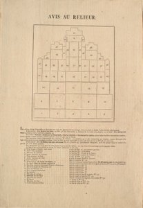


.jpg "ニューヨーク市の13の市場の基本計画、1833年(黒インク、カラーウォッシュ付き、紙の上)")


.jpg "これまでに描かれた山の丘")


.jpg "地質学、1833-39")
.jpg "ハプスブルク家のフェルディナンド1世皇帝とルドルフ1世からのヨーロッパの支配者の家系")


.jpg "タワーのロイヤルミントの計画、1701年")


.jpg "牛肉: さまざまな部位を示す図")

.jpg "ホメロスの『イリアス』の記述によるアキレウスの盾、1815年")


.jpg "『六つの頭を持つ男』、シャルル・モーリス・ド・タレーラン=ペリゴール(1754-1838)の風刺画、1815年")


 (c90-168 AD) - (MeisterDrucke-65091).jpg "プトレマイオス(アレクサンドリアのクラウディオス・プトレマイオス)(紀元90-168年頃)の「地理学」に記された記述と座標に基づく世界地図")
.jpg "キングス・ロードの地図、ロンドン、1746年")
.jpg "ネールウィンデンの戦いの地図、ウィリアム・ブラックウッド・アンド・サンズ刊、エディンバラおよびロンドン、1848年")
 - (MeisterDrucke-195383).jpg "委員会計画、1807年4月3日に可決された法律により任命された委員によるニューヨーク市地図、P・マーヴェリック版画、1811年")

 - (MeisterDrucke-191935).jpg "インド地図、William Blackwood and Sons刊、エディンバラおよびロンドン、1848年")

.jpg "テキサス州の地図、1835年")
.jpg "リール市の地図、『Atlas et Histoire de Lille』より")
 - (MeisterDrucke-111556).jpg "アトラス131 F fol. 2、バ・ポワトゥー、ペイ・ドニ、サントンジュおよびメドックの地図、『サントンジュ地図集』より")

.jpg "ロンドン、コヴェント・ガーデンとウェストミンスターの地図、1746年")
.jpg "ティコ・ブラーエの地球を中心とする惑星軌道体系を示す地図、ヨハネス・ヤンソニウス刊『天球図譜、または宇宙の調和』(Atlas coelestis seu harmonia macrocosmica)より")
.jpg "サルバドール、エスパノラ、フェルナンダ、イザベラ、コンセプションの島々を描いた地図、1493")
 - (MeisterDrucke-123182).jpg "新しく正確な世界地図、1676年")
.jpg "放蕩息子の帰還")
.jpg "ウィトルウィウス、リュック・ヴィアトゥール")
.jpg "疾走する馬に乗るジョッキー、『アニマル・ロコモーション』第627図版、1887年")
.jpg "編み物をしながら揺りかごの幼児を見守る少女")
.jpg "戦艦テメレール、1839年")
.jpg "ホロフェルネスの首を持つユディト")


.jpg "若い女性の肖像")
.jpg "四季:春、1896年")
.jpg "青い踊り子たち、1890年")
.jpg "雲海の上の旅人")

.jpg "カササギ")

 +43 4257 29415
 support@meisterdrucke.com
 Mo-Do: 7:00 - 16:00 | Fr: 7:00 - 13:00




